Mon 16 Mar 2015
West Marin’s bridges to its past
Posted by DavidMitchell under General News, History, Point Reyes Station
[3] Comments
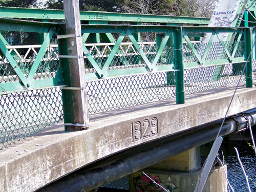
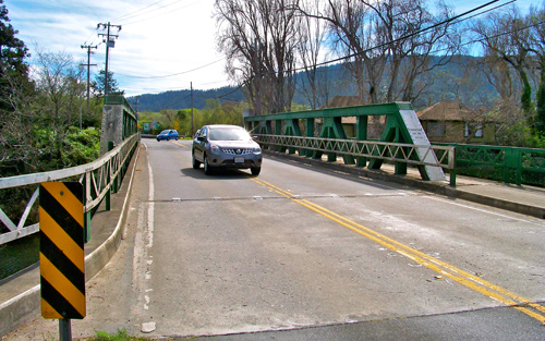
Caltrans plans to hold a public meeting from 7 to 9 p.m. this Thursday, March 9, at West Marin School to discuss replacing the Green Bridge which carries Highway 1 over Papermill Creek in Point Reyes Station.
You’re familiar with Caltrans’ bridge work, I’m sure. Its star-crossed replacement of the eastern span of the Oakland Bay Bridge has become an endless story in the Bay Area news media.
Caltrans, which wants to spend $5.8 million replacing this bridge, says it has come up with four designs for a new one. The public will have a chance Thursday to comment on them.
In the mid-1800s, Olema was a far busier place than Point Reyes Station, and a ferry carried travelers going back and forth between the two towns. In 1875, the County of Marin built the first bridge in this location. Its modern replacement was obviously built in 1929.
This 100-foot-long span on Highway 1 carries approximately 3,000 vehicles per day, 4 percent of them trucks, Caltrans reports. The 10,000-foot-long Bay Bridge on Interstate 80 in comparison carries about 240,000 vehicles per day between Oakland and San Francisco.
Caltrans questions whether the 24-foot-wide Green Bridge is earthquake safe, saying its structure is okay, but its “deck geometry” is “basically intolerable.”
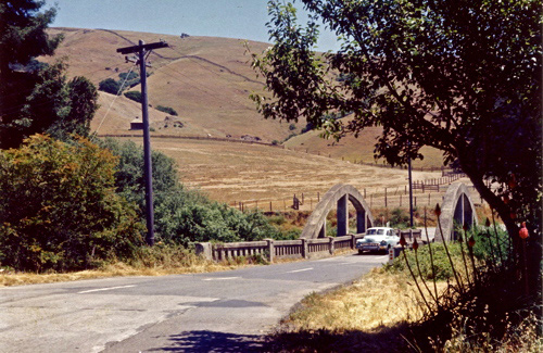
1959 photo by D.M. Gunn, courtesy of Dewey Livingston
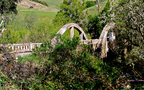
The old Tocaloma Bridge was built in 1927 to carry Sir Francis Drake traffic over Papermill Creek in the town of Tocaloma, which lies 1.8 miles east of Highway 1 at Olema. The bridge was designed by J.C. Oglesby.
Oglesby also designed the matching Alexander Avenue bridge still in use in Larkspur. (Wikipedia Commons photo)
Oglesby’s old Tocaloma Bridge as it looks today.
The new Tocaloma Bridge carrying Sir Francis Drake traffic over Papermill Creek is immediately upstream from the old bridge. The state built the new bridge in 1962 at a cost of $210,000.
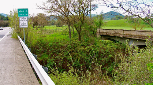
San Antonio Creek forms the boundary between Marin and Sonoma Counties, as seen from the Point Reyes-Petaluma Road while heading west.
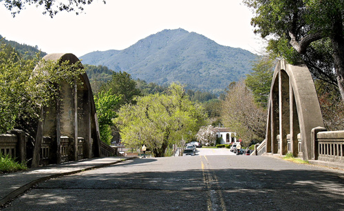
The San Antonio Creek Bridge along the Point Reyes-Petaluma Road straddles the Marin-Sonoma county line just east of Union School.
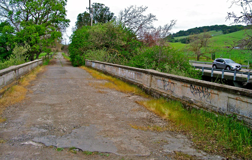
The 102-foot-long bridge over San Antonio Creek was built in 1919 and replaced in 1962.
The continuous-concrete-slab construction of the 1919 bridge still looks solid. However, the bridge’s width and deteriorating pavement brought about its being replaced with the wider, better-paved bridge beside it.
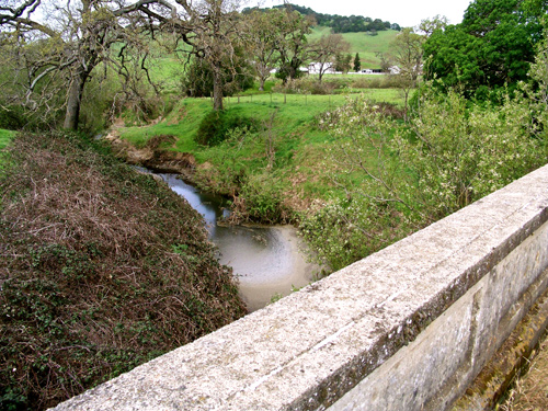
When I set off to shoot these photos, I was well aware that West Marin’s abandoned bridges are in scenic locales, but this view from the old San Antonio Creek Bridge was, nonetheless, a pleasant surprise.
If Caltrans has its way, the Green Bridge will likewise be abandoned in the near future. Will it then become an historic relic like these? Or will it be cut up and sold as scrap iron?




I remember seeing a bridge near the highway we took on our way to the ferry my last day. It didn’t seem to have a road connected to it that was in use. Lynn pointed it out and explained what it was. Beautiful pictures!
Enjoyed this column. So many memories of the Green Bridge. Loved the old photos with the arched bridges.
Thanks for the post! Great bridges they are.