History


The Jack Mason Museum of West Marin History in Inverness on Saturday unveiled a new exhibit, Inverness Yacht Club. It features photographs from the museum’s archives, as well as a few items loaned to the museum by the yacht club.

The exhibit covers the first Inverness Yacht Club from 1912 through 1940, the in-between years when Del Bender owned the building, the new Inverness Yacht Club of 1949, and the celebration in July 1950 when the club was rededicated. There are also some later photographs.

Meg Linden (right), treasurer of the Jack Mason Museum of West Marin History, and Ann Read with her dog Coco greet guests at the exhibition.

A photo that the late newspaperman Peter Whitney, who had a home at Chicken Ranch Beach, donated to the museum in 1999.

A burgee is the distinguishing flag of a recreational boating organization.

Nautical etiquette holds that members’ boats may fly their burgees while sailing or at anchor, day or night, but not while racing. Or so writes R.L. Hewitt, commodore of the Royal Yachting Association in 1969 and 1984, in Flags and Signals.

Brock Schreiber’s boathouse was built from 1911 to 1914, its wharf in 1908. The boathouse in 1978 was placed on the Register of National Historic Places.

In the early 20th century, weekend travelers to Inverness often got off the narrow-gauge railroad in Millerton and rowed across the bay in skiffs kept on the beach. “Brock Schreiber met the train in a launch if he knew anybody was coming,” historian Jack Mason wrote in Point Reyes the Solemn Land.

“One Inverness pioneer, Mabel Reed Knight, regaled friends for years with her story of getting off the train at Millerton, expecting to be ‘met.’ She shrieked across the mile-wide bay at Schreiber, and unable to raise him, hiked [around the foot of Tomales Bay] the eight miles to Inverness, suitcase and all, ‘with a dog nipping at my heels all the way.'”

“….These years were golden for Inverness. Schreiber’s two launches, the Kemah and the Queen, took excursionists down Tomales Bay; his rental sailboats were at the beck of weekenders.”

Independence Day at Shell Beach in the 1930s.

A sideview of the yacht club with people on the deck circa 1952.

Admiral Chester Nimitz and his wife Catherine at the Inverness Yacht Club in 1950.

During World War II, Admiral Nimitz was promoted to Fleet Admiral of the US Navy and won a series of decisive victories against the Japanese at islands throughout the South Pacific. In 1945 aboard the Battleship Missouri in Tokyo Bay, the admiral represented the United States in signing Japan’s document of surrender.

Aerial view of the Inverness Yacht Club and Cavalli’s pier (at center) in 1956.

The Small Boat Racing Association hosted by the Inverness Yacht Club in 1976.

The Lark, Spring Maid, and Skip Jack in a 1920 race off Brock Schreiber’s wharf.

Jim Barnett (center) racing his Flying Scot in 1980 with his crew.

The exhibit is open the same hours as the Inverness Library, with which it shares its building, Monday from 3 to 6 p.m. and 7 to 9 p.m., Tuesdays and Wednesdays from 10 a.m. to 1 p.m. and from 2 to 5 p.m., Fridays 3 to 6 p.m., and Saturdays from 10 a.m. to 1 p.m.

“Tomales Union High School opened on Aug. 5, 1912, with 23 students and one teacher/principal,” notes a Tomales Regional History Center Bulletin. On Sunday, Aug. 5, the museum opened an exhibit celebrating the school’s last century.

Approximately 300 people, including many former students, packed the history center, which is located in the high school’s former gym in downtown Tomales. The crowd at times was so thick that just getting around in the history center required a litany of “excuse me, excuse me, excuse me.”

The original Tomales High schoolhouse.

The class of 1916 was the first to complete four years at the high school. Teacher Edith Wilkins is at left and principal Benjamin Pratt is at right. Between them are (from left) students Marie Dempsey, Elsie Basset, Truman Fairbanks, Jane Burns, and Vivian Swanson.

Before the two-classroom school was a decade old, it was expanded to 10 classrooms thanks to a $30,000 school bond. “A hyphen-like hallway,” in the words of the history center, connected the new classrooms with the original school.

“The boys locker room in the school’s basement was one of the amenities of the larger school,” notes the history center.

Tomales High’s first school bus was chain-driven. Standing outside the bus is student and driver Harold Maloney, class of 1919. Original photo by Ella Jorgensen.

Tomales High’s third school bus as seen in the 1930s.

Attending Sunday’s opening of the exhibit was May Velloza of Point Reyes, a 1946 graduate of Tomales High and a school bus driver for almost eight years in the 1970s. How did students on the bus behave back then? “I had really good kids,” she replied. “You know why? ‘Cause I knew  the parents.”

Tomales High’s first agricultural teacher, William Reasoner, started the Tomales chapter of Future Farmers of America in 1929. Here is Reasoner with his National Champion dairy-cow judging team in 1931. From left: Reasoner, Neibo Casini, Donato Albini, Donovan Rego, and Ed Williams.

The National Championship trophy.

During Sunday’s opening of the history center exhibit, guests could also get tours of the new high school to see recent construction there.

The California Field Act mandates that all the state’s public schools be earthquake safe, and Shoreline School District trustees in the 1960s were faced with either retrofitting the old school or building a new one.

“Bond elections to finance various options followed and were twice narrowly defeated,” the history center bulletin notes. “One vocal group of residents believed the school should be abandoned altogether and its students dispersed to other, larger schools. Thus the question of Small-local-school versus Larger-more-specialized-school insinuated itself into the referendum process, its echo reverberating to this day.

“Finally in 1967 a third election was successful. Affirmative votes in all precincts except Inverness resulted in an overall 73 percent approval for the $1.1 million bond to finance a new high school. In a busy two years, a piece of property just east of Tomales was purchased from Romero Cerini; architects and contractors were consulted. The trustees worked hard to educate themselves about modern high school design.”

In 1969, the new high school opened along the Tomales-Petaluma Road.

Remnants of the old school. After the new high school opened, the old campus was largely unused, and in November 1977, most of the old school burned in a fire that many people suspected was arson although that was never established.

Left undamaged by the fire was the school’s gym, and in 1998 the building was restored to become the Tomales Regional History Center where the school exhibit is now on display.

Tomales High’s sports teams have done well over the years. The girls volleyball team won its division in 1998.

During World War II, Tomales High sports were limited to intramural games. The history center bulletin explains why:

“Student Kathie Nuckols (Lawson) clearly remembered the Monday morning of Dec. 8, 1941, little more than 24 hours after Pearl Harbor was bombed. ‘Our principal called all the students… into the auditorium to hear President Roosevelt call our country to war. His voice came through a small radio, and we strained to hear his words, overwhelmed by the drama as only teenagers can be.’

“Blackout shades lowered in the auditorium, tanks passing the school on their way to occupy Dillon Beach, the imposed limits on travel because of gas rationing, especially affecting the sports programs which were, for the duration, limited to intramural games. These are some of the things students of the war years remembered.

“Yet these events were undoubtedly put into perspective by the biggest effect of all, the nine Tomales High students who did not come home from the war.”

The 1946 Tomales High band.

The 1954 band performs at a football game.

The Tomales High band in 1973. The school didn’t hold a nighttime football game until 2004.

Tomales High teams were originally called the Wolves, but in 1950, the name was changed to the Braves. Originally the mascot was symbolized by a cartoon-like Indian, but that image was later changed to the one here. In 2001, Shoreline School District trustees decided the name was disrespectful to Native Americans and voted to change it.

However, many district residents objected, including several Miwok descendants who said the name had been changed to Braves to honor them. A petition signed by 90 percent of the student-body objected to the change, and more than 100 of the school’s approximately 175 students cut class for half a day in protest.

Eventually the trustees voted to keep the name Braves but to drop the Indian image, saying it looked like a Great Plains Indian, not a Miwok.

Sports, agriculture, and sewage. Cows peacefully graze beside the town sewage ponds Sunday afternoon. The bleachers of Tomales High’s ballfield are in the background.

The tranquility of this scene was in sharp contrast to the high-spirited crowd at the history center. The biggest contrast of all, however, occurred a few hours later.

NASA illustration of Curiosity on Mars.

About 10:30 p.m. local time, a global audience went into a frenzy of excitement as NASA scientists endured what they called “seven minutes of terror” and gently landed a sizable exploratory-robot called Curiosity on the planet Mars 154 million miles away. What an historic day!

The Marin County Deputy Sheriffs Association held its annual barbecue Sunday at Stafford Lake. There were no reports of rowdy deputies crashing cars or getting in fights with each other. It wasn’t always like that.

A just-released book, Resident Deputy Sheriff In Wild and Wooly West Marin: 1964 to 1969 and then some!, describes heroism, humor, and scandals within the Marin County Sheriff’s Office four decades ago.

Numerous well-known residents of West Marin play roles in the book: retired Judge Dave Baty of Inverness Park, retired Sheriff’s Sgt. Russ Hunt of Point Reyes Station, the late Sheriff’s Capt. Art Disterheft of Olema (for whom the Public Safety Building in Point Reyes Station is named), and others.


Sheriff’s Capt. Art Disterheft (left) and Sgt. Weldon Travis in Inverness Park during the Storm and Floods of  1982. Portrait copyright Art Rogers/Point Reyes

Written by a retired sheriff’s sergeant, the book provides — among other things — an insider’s look at the sheriff’s office during the 1958-to-1978 tenure of Sheriff Louis Mountanos who, according to the author, had ties to La Cosa Nostra.

Weldon Travis, the author, knows West Marin well. He moved to Woodacre after high school, attended the College of Marin, and in the 1960s became a deputy in the county sheriff’s office.

While still a young officer, Travis was made a resident deputy in West Marin, meaning he was patrolling the area where he lived.

Along with accounts of heroism, tragedy, and official wrongdoing, his book includes numerous anecdotes that are humorous in the understated vein of Sheriff’s Calls. But unlike them, he often names names:

“I had a civil paper to serve on George [Gallagher of Nicasio], nothing serious, and went to his house.” His wife told me he and a bunch of his friends were deer hunting a few miles away in the canyons along Wilson Hill.

“George was getting along in years, so he was sitting down near the base of a canyon as some of the younger guys were hopefully driving the deer toward the older ones.

“I spotted George’s International jeep and figured I’d find him, hopefully without messing up the hunt. I stayed in the open and moved slowlyas I didn’t want to get shot by accident.

“Pretty soon I heard a big one come crashing down through the oaks and madrones, then the nearby crack of a rifle. I moved that way and found George sprawled on the hillside between some big rocks. The big ol’ buck had knocked him ass over teakettle downhill.

“George looked up at me with kind of a dazed expression on his face, and in that high voice of his asked, ‘Weldon, how did you get here so quick?” I just grinned at him.

Retired Sheriff’s Sgt. Weldon Travis at the Pinecone Diner Saturday.

Another of his stories tells of a naked man high on drugs trying to have sex with a patrol car’s red light as a new deputy from Nicasio, Joe Dentoni, drove around Point Reyes Station.

Still another story tells of stopping a motorist in the San Geronimo Valley late one summer evening. Seeing the man’s car wandering around its lane at varying speeds, Travis assumed he was dealing with someone who was either really sleepy or intoxicated.

However, when Travis turned on his siren, up popped a blonde, long-haired woman, sitting bolt upright in the front passenger seat. After talking with the two and running a warrant check, Travis writes, I sped off, leaving them to recompose themselves at roadside.

Some of Travis’ stories are grim. A cat lady, who had been dead for several days, was found at home in Woodacre. The cats didn’t have any food except her. Travis helped the coroner put her in a body bag although her forearm skin slipped off as I pulled her off the bed.

More emotionally wrenching for Travis was arriving at a Lucas Valley Road home just as a resident committed suicide with a gunshot into his mouth and brain.

After the coroner had come and gone, Travis gathered up the blood-soaked quilts, blankets, sheets and pillows and threw them in the trunk of the patrol car.

The new widow and I got some Clorox from under the sink and got down on our hands and knees together and scrubbed and scrubbed.

At home, I washed all of that stuff three times, but it was useless. It all went to the dump. My emotions and some of my sanity took a dump too.

Travis describes the suicide of a fellow officer, as well as his own alcoholism, marital infidelities and indiscretions.

“Why do I share this?” he asks at one point. “So you might understand what we who serve you do. We pay a price, but that’s okay; it’s our choice. And that’s why we drink, have failed relationships, and commit suicide after our usefulness to our society seemingly has been utilized.

Travis also marvels at the heroic strength of some of the public with whom deputies deal.

In a section titled Abbott’s Lagoon Drifter, the author tells of two, young lady-friends who calmly reported that an armed, would-be rapist had accosted them at Abbott’s Lagoon in the Point Reyes National Seashore.

One of the young women had learned martial arts while attending UCLA, and together they took the drifter’s gun away and violently beat him. With help from the public and a marijuana-hunting helicopter, deputies a day later found the man and arrested him.

“He pled guilty and, in view of his extensive rap sheet from across the Midwest, went to prison for a long time,” Travis wrote, adding, “Good community effort!”

Ironically, Travis himself doesn’t tell the story for which he is best known although his book includes an epilogue of news clippings that tell it for him.

In the 1950s while Travis was a starving student at the College of Marin, he was hired to pose naked for a photographer who said the pictures would be used in art classes.

Around 1966, after Travis was working for the sheriff’s office, pirated copies of the photos began circulating in the soft-core porn world. Soon they were showing up in gay men’s magazines such as Tomorrow’s Man, Fair Fellows, and Times Square Stud.

Someone (Travis believes it was an organized-crime figure whose toes he had stepped on) brought the photos to the attention of Sheriff Mountanos, who fired him.

The indiscreet photos would cause the public to lose confidence in him, the sheriff claimed. The claim, however, was met with a chorus of outrage from members of the public who noted what a good deputy Travis was.

Several people wrote letters to the Marin Independent Journal, saying that nothing about posing nude for an art class disqualified Travis to later work as a deputy.

With Judge Baty defending him, Travis took his firing to the county personnel commission, who reinstated him on a 4-to-1 vote.

The late San Francisco Chronicle columnist Herb Caen at the time wrote that Mountanos had “made himself look fairly ridiculous” and noted that future President Herbert Hoover had helped pay his way through Stanford University by “posing in the raw for art students.”

Weldon Travis and his wife whom he refers to as “Serene Irene, the Bawdy House Queen.”

Travis, now 74, lives in the town of Rough and Ready, Nevada County, where he is married to an 80-year-old artist, former beauty queen, and model named Irene.

Once known as a somewhat-hippie deputy, Travis is now a full-fledged-hippie political conservative — sporting long hair, a ring in his ear, and Indian jewelry. How did that change come about?

Irene said they consider themselves “compassionate conservatives,” socially liberal and economically conservative. Above all, the former sheriff’s sergeant is overtly skeptical about the workings of government. Perhaps from seeing them at close range.

Resident Deputy Sheriff is available at Point Reyes Books for $22 hardback and $12 softcover. Non-West Marin residents can find it in some East Marin bookstores and online.

“Did you know that three-colored cats are almost always female? Years and years ago, P.T. Barnum offered $1,000 for a male three-colored cat. He never got one.”

This bit of trivia comes from the 200th edition of The Old Farmer’s Almanac, which was published in 1992. This year we’ve reached the 220th edition.

The almanac has to be some of the most-enjoyable reading anywhere.

For example, here are some “actual quotes from accident reports submitted to insurance companies by hapless policy holders, as collected by the United Services Automobile Association.”

They were reprinted in the 200th edition:

“Coming home, I drove into the wrong house and collided with a tree I don’t have.”

“The guy was all over the road. I had to swerve a number of times before I hit him.”

“I pulled away from the side of the road, glanced at my mother-in-law, and headed over the embankment.”

“I had been driving for 40 years when I fell asleep at the wheel and had an accident.”

“The telephone pole was approaching. I was attempting to swerve out of its way when it struck my front end.”

In the words of Wikipedia: “The Old Farmer’s Almanac is a reference book that contains weather forecasts, tide tables, planting charts, astronomical data, recipes, and articles on a number of topics including gardening, sports, astronomy and farming.

“The book also features anecdotes and a section that predicts trends in fashion, food, home décor, technology and living for the coming year. Released the second Tuesday in September of the year prior to the year printed on its cover, The Old Farmer’s Almanac has been published continuously since 1792, making it the oldest continuously published periodical in North America.”

The paperback copies always come with a hole punched through the upper left corner to make it easy to hang the almanac on a nail in outhouses and, later on, in bathrooms. For centuries, both have doubled as reading rooms. And in emergencies, the almanac’s light-weight pages have been substituted for toilet paper. Or so I read.

At the time John B. Thomas launched The Farmer’s Almanac, there were many competing almanacs around. When his outlived the rest, Thomas in 1832 changed the name to The Old Farmer’s Almanac but dropped the “Old” in 1836. Thomas died in 1846, however, and in 1848, the name reverted to The Old Farmer’s Almanac.

The Old Farmer’s Almanac formula for predicting weather is kept locked in a black tin box at the company office in Dublin, New Hampshire.

For his weather predictions, Thomas studied solar activity, astronomy cycles and weather patterns. He used his research to develop a secret forecasting formula, which is still in use today. Other than the almanac’s prognosticators, few people have seen the formula. It is kept in a black box in the almanac’s office.

During World War II, a German spy was caught in New York with a copy of the 1942 Old Farmer’s Almanac in his pocket. As a result, the almanac from 1943 through 1945 featured “weather indications” rather than “forecasts” in order to comply with the U.S. Office of Censorship’s voluntary Code of Wartime Practices for press and radio. The temporary change allowed the almanac to maintain its record of continuous publication.

Old Farmer’s Almanac founder John B. Thomas at right.

While many people buy The Old Farmer’s Almanac for its cooking and gardening tips, its bizarre tales (all supposedly true) have since its founding been a primary attraction. Take this story written by Bernard Lamere:

“During the Civil War, Union doctor Capt. L.G. Capers was acting as a field surgeon at a skirmish in a small Virgina village on May 12, 1863. Some distance to the rear of the captain’s regiment, a mother and her two daughters stood on the steps of their large country home watching the engagement, prepared to act as nurses if necessary.

“Just as Capt. Capers saw a young soldier fall to the ground nearby, he heard a sharp cry of pain from the steps of the house. When the surgeon examined the infantryman, he found that a bullet had broken the fellow’s leg and then ricocheted up, passing through his scrotum.

“As he was administering first aid to the soldier, Capt. Caspers was approached by the mother from the house to the rear. Apparently one of her daughters had also been wounded. Upon examining the young woman, Caspers found a jagged wound in her abdomen, but he was unable to tell where the object had lodged.

“He administered what aid he could for such a serious wound, and he was quite pleased to see that she did recover from the injury. Thereafter it was a full eight months before the captain and his regiment passed through the same area, at which time he was quite surprised to find the young woman very pregnant.

“Within a month, she delivered a healthy baby whose features were quite similar to those of the young soldier who had been wounded nearly at the same instant the girl had been struck nine months earlier.

“The surgeon hypothesized that the bullet that struck the soldier had carried sperm into the young woman’s uterus and that she had conceived.”

The denouement was that the “soldier and young woman courted, fell in love, and married, later producing two more children using a more common method.”

One of the amazing aspects of The Old Farmer’s Almanac is how inexpensive it has always been. You can buy a copy for only $5.99 online from the publisher or a hardcover edition for only $7.98. I received my 200-year-anniversary copy as a gift from colleagues, and it really is a wonderfully entertaining gift for yourself or a friend.

Through June 30, the Jack Mason Museum of West Marin History in Inverness is exhibiting an “historical view” of Inverness Park. Although the Census Bureau and the Postal Service lump the town in with Point Reyes Station, Inverness Park is far older.

Much of the area was once owned by Rafael Garcia, who in 1836 was issued a Mexican land grant for three square miles at Bolinas. In 1843, he moved his ranch further north so that his brother-in-law Gregorio Briones could have the land in Bolinas. Mexican authorities subsequently granted Garcia “judicial possession” of his new holdings.

However, in 1860, two lawyers from Vermont, Oscar and James Shafter, claimed that 9,000 acres of Garcia’s northern holdings actually belonged to them. They argued that they had acquired adjacent holdings which supposedly included Garcia’s land. The dispute, of course, went to court, and after six years of intense litigation, Garcia’s ownership was finally upheld on Feb. 21, 1866.

“Whatever joy it gave Rafael Garcia was short lived,” the late historian Jack Mason wrote in his book Point Reyes the Solemn Land. “Within 10 days, the old man was dead, his inquisition over.” He was 74.


A water tank at White House Pool collapsed in the 1906 earthquake.

Somewhat surprisingly, Garcia descendants had once operated a dairy where the county parking lot for White House Pool is today. There was also a second dairy in Inverness Park.

The Lockhart family operated Pinecrest Dairy near the top of Balboa Avenue (where it turns into Drakes Summit Road) until 1961. The dairy, which is across the street from the former St. Eugene’s Hermitage, is now occupied by Doug and Margaret Moore. The dairy barn is still intact but not visible from the road.

The center of Inverness Park has always been its grocery stores. This is how the first store, which also sold gasoline, looked after it was remodeled in the 1930s.

In the 1920s, Michael and Filomina Lucchesi Alberigi “bought about five acres on the marsh side of Inverness Park and moved into a large home there,” the museum publication Under the Gables reports. “They built barns behind the house. They grew vegetables and eventually used a small house next to their home as a general store. Later it also had a small café and became the social hub of the village.”

In 1949, the Alberigi family leased the old store to Annie and Victor Turkan to run while the Turkans built a larger store across the street.

This is the cover photo of the Spring 2012 issue of Under the Gables, which is devoted to the Inverness Park exhibit. Here’s what the new store, which would become Perry’s Deli, looked like in its early days.

“After the Turkans retired, their daughter Wilma Van Peer, who lived next door in what is now Spirit Matters and had the first television set in Inverness Park, ran it,” Under the Gables notes.

“In the 1960s, Vern and Diane Mendenhall bought it from Van Peer and expanded it to include a diner made out of a railway car. Greg (last name unknown for now) bought it from the Mendenhalls and later sold it to Bill and Irene Keener. The Keeners sold it to Dan Thompson over 30 years ago.

“In the early 1970s, the diner was a pizzeria. It then became a succession of bakeries under various names and owners: Foggy Mountain Bakery run by Mountain Girl (Jerry Garcia’s first wife) with Kate Gatov and Irene Keener; Kate sold out to the Keeners, and it was briefly known as Bill’s Bakery; [Station House Café founder] Pat Healy for a brief time; Knave of Hearts Bakery run by Matthew and Robin Prebluda; Debra’s French Bakery (Debra had partners with Brigit Devlin in starting the Bovine Bakery in Point Reyes Station); and now the Busy Bee Bakery.”

The old store, which the Turkans closed after their new store opened, became ranchworker housing for the neighboring Giacomini dairy.

Eventually, however, it fell into disrepair (as can be seen at right).

By then, the federal government owned the site.

The National Park Service tore the old building down in 2007 and in 2011 erected a kiosk where it had been.

The kiosk (at left), is across Sir Francis Drake Boulevard from Perry’s Deli.

It provides information on the Park Service’s efforts to return the Giacomini ranch to wetlands.

It also displays minutes of an Inverness Park Association meeting a year ago when the kiosk was discussed. The National Park Service, president Donna Larken noted, had said its work on the kiosk was done although benches (visible above) in the kiosk had not yet been installed.

Another bit of Inverness Park history that has also disappeared is the California Trout Farm.

It was built in 1910 on Fish Hatchery Creek (next to Portola Avenue) and had a contract to supply the California Department of Fish and Game with trout. Individual fishermen could also come to catch and barbecue their fish.

The hatchery closed during the Great Depression but was revived and restocked in 1949.

In the foreground are Rose Alberigi and her daughter Edna with an unidentified boy during the early days of the hatchery.

The revived trout farm didn’t last long, and its concrete ponds were torn down in the 1950s. “There is part of one pond left, but it may be from an even earlier operation,” Under the Gables explains.

The Inverness Park photographic exhibit at the museum was in large part organized by Meg Linden with photos drawn from several collections. The museum is open whenever the Inverness Library, which shares its building, is open: Monday from 9 a.m. to 6:30 p.m., Tuesday 9 a.m. to 6:30 p.m., Wednesday 10 a.m. to 6:30 p.m., Thursday 9 a.m. to 8 p.m., Friday 9 a.m. to 6:30 p.m. and Saturday 9 a.m. to 6:30 p.m.

The posting that follows is not a history of the North Pacific Coast Railroad or its successors, the North Shore Railroad and the Northwestern Pacific. Rather it consists of a few glimpses of the wondrous line as it evolved over 58 years and then for the most part faded away.

More than half the towns in West Marin grew up along the tracks of the North Pacific Coast narrow-gauge railroad. In 1875, the line opened between the Sausalito ferry terminal and Tomales by way of Point Reyes Station. Soon it was extended to Cazadero’s logging camps.

The narrow gauge makes a morning stop in Lagunitas around 1915. By then, the tracks east of Manor (now part of Fairfax) had been converted to standard gauge with an electrified third rail powering the locomotives.

In order for trains to travel between the San Geronimo Valley and Manor, the narrow gauge required two tunnels to get through Whites Hill: “a small one at the bottom behind White Hill School and the longer one at the top, which passed directly under the current [Sir Francis Drake Boulevard] pass,” historian Dewey Livingston of Inverness told me.

These were replaced in 1904 by the Bothin Tunnel on the south side of Woodacre. The Bothin Tunnel was sized to accommodate standard-gauge railroad cars, which in 1920 took over the stretch from Point Reyes Station east to Manor.

After the standard gauge shut down in 1933, the Bothin Tunnel remained open, primarily for fire engines from the county fire department in Woodacre en route to fires in East Marin. After many years, however, the Bothin Tunnel was closed by a fire and cave-in, Livingston added.

A northbound train crosses the Point Reyes Station trestle.

A particularly wretched part of the line was this trestle over Papermill Creek immediately east of Point Reyes Station. A sharp curve in the tracks just west of the creek was followed by a reverse curve on the trestle itself.

On June 21, 1903, one of the worst wrecks in the railroad’s history occurred at the trestle.

A special train had been chartered to carry friends of Warren Dutton, a founder of Tomales, to the town for his funeral. Returning southbound, the train, which had been traveling fairly fast all the way from Tomales, crossed the trestle a little too fast.

The engine and its coach fell off the trestle and landed upside down, killing two passengers. Four other passengers and the conductor were badly injured. Just three days later, another train ran off the tracks in nearby Tocaloma, crushing the engineer beneath the cab.

Three years later, the Point Reyes Station trestle experienced more misfortune when it was severely twisted (left) by the 1906 earthquake.

The trestle, however, was quickly repaired.

Similar damage occurred in Tomales and along the railroad bed beside Tomales Bay.

As the late railroad historian Bray Dickinson of Tomales noted in his 1967 book Narrow Gauge to the Redwoods, “Anticipating a big summer business, the narrow gauge company intended to start a new schedule on the day of the earthquake.

“The San Francisco morning newspapers never delivered because of the catastrophe — carried the North Shore timetable which provided a record four passenger trains daily to Cazadero and two additional locals for Point Reyes Station.”

In Tomales, the quake caused a hillside to collapse, tangling the tracks.

In the railroad’s early days, Tomales was the most prosperous West Marin stop, and nearby hamlets were also bustling places. Here a giant round of cheese awaits being picked up in 1894 at the train platform in Fallon.

In the 1890s, Engine 13 wrecked at Clark Summit just north of Fallon. The site is now part of Clark Summit Farm, an organic beef, pig, and chicken operation owned by Liz Cunninghame and her husband Dan Bagley.

Nowadays, most motorists on Highway 1 south of Tomales are familiar with these steel piers, which once held up a trestle spanning Keys Creek.

Far fewer people, however, have any idea how the trestle looked when it carried trains. In fact, remnants of the old railroad provide only a hint of the grand system it was.

For motorists heading north on Highway 1 from Point Reyes Station, the first turnout where they can stop and view Tomales Bay overlooks what was once a commercial area known as Bivalve. This long-gone oyster building was Bivalve’s dominant structure.


North of Bivalve, the old railroad bed along the shore is barely discernible these days.

In railroad days, however, this approach to Bivalve was a scenic part of the trip.

South of Bivalve, the railroad bed skirted a small lagoon as it crossed to Railroad Point on Martinelli property.

I know the spot well, for the late Sheriff’s Capt. Art Disterheft and I were once kayaking in the lagoon when we discovered we were virtually trapped by a strong incoming tide through the entrance channel (foreground at right).

We finally escaped by paddling frantically only to then hear someone on the turnout above us laughing loudly at our predicament.

The photo at right of a southbound train leaving Bivalve en route to Railroad Point was shot in June 1906. “This was two months after the great earthquake, which badly damaged this section of line along Tomales Bay,” Dickinson noted.

“Repairs had been rapidly made and regular trains were running over the entire line within three weeks. Uneven track ahead of Engine 3 marks quake damage.”

Although the tracks heading east from Point Reyes Station were converted to standard gauge in 1920, the tracks north of town remained narrow gauge. In 1930, the narrow-gauge section shut down, and in 1933, the standard-gauge section did too.

Much of the material for this posting comes from Dickinson’s book Narrow Gauge to the Redwoods. Anyone who lives in West Marin and is interested in its history should have a copy. The book was edited by historian Ted Wurm, who died in 2004, while most of its photos are from the late Roy Graves’ collection.

Point Reyes Station’s “birth can be pinpointed: Jan. 7, 1875, the day the first train came through on its way to Tomales,” the late historian Jack Mason of Inverness wrote in Earthquake Bay, A History of Tomales Bay, California (North Shore Books, 1976).

The train’s “first sightseers viewed Olema Station (its name for seven years) with unbelieving dismay. ‘The depot is in a wilderness!’ one of them wrote. And so it was: 11 acres of Mary Black Burdell’s cow pasture: no hotel, no sandwich stand or saloon.

“To reach Olema two miles distant, where many were headed, was well nigh impossible, with Papermill Creek to cross and no bridge or stageline,” Mason wrote. Back then Olema, whose downtown was much larger than it is today, was the commercial hub for the foot of Tomales Bay. It boasted two restaurants, two hotels, six bars, a racetrack, a school, a Catholic Church, and a Druids Hall.

In less than a year, a bridge providing access to Olema was built across Papermill Creek, but by that time, Mason observed, “passengers had a hotel nearer at hand …. ‘with the only saloon serving a vast and thirsty land.'” The hotel and saloon, which Dr. Galen Burdell built, were right across the street from the train depot.

Dr. Galen Burdell’s saloon.

Mary Black Burdell was married to dentist Galen Burdell and was the daughter of rancher James Black of Nicasio. Black Mountain, which provides the backdrop for Point Reyes Station, is named after him. In 1961, the site of Black’s ranch house was inundated by the completion of Nicasio Reservoir, but whenever the reservoir runs dry during droughts, the house’s foundation can still be seen on the western shore.

When the train depot opened in Mary Black Burdell’s pasture, Black had been leasing land nearby to former Sheriff James T. Stocker, who operated a dairy ranch on it. Today, “Stocker’s ranch site is marked by the cypress trees right across Highway 1 from Campolindo Road and [by] a couple of fruit trees,” Dewey Livingston, the reigning historian of Inverness, told me. “They all overlooked Tomasini Creek.” This this no doubt explains why Tomasini Canyon, where the old sump was located, for years was known as Stocker’s Gulch.

In the area around the depot, Mrs. Burdell gave her husband 950 acres of land she had inherited. The property would become the site of Point Reyes Station, and until the dentist’s death in 1906, “the town was his plaything,” wrote Mason. “By 1880, Burdell’s Station, as some called it, had all the appurtenances of civilization: a blacksmith shop, livery stable and butcher shop.”

A small school was erected in 1879, but in 1905 it was replaced by Black School (above), which was named after Mary Burdell’s father. The wooden, two-story structure was located where the firehouse is today.

The first store in town was built in 1883 at Second and A Streets by A.P. Whitney and Company of Petaluma but was sold four years later to Salvatore Grandi. The “Swiss farmer,” as Mason described Grandi, turned the business into a general store called Grandi’s Mercantile Company.

(It should be noted there is no street named Main Street in Point Reyes Station. The correct name for the main street is A Street or, if you prefer, Highway 1.)

The first post office opened on May 23, 1882, and the town changed names from Olema Station to Point Reyes the same day. The town’s name changed again, to Point Reyes Station, on Aug. 10, 1891, so its mail wouldn’t accidentally be sent to the post office at F Ranch on Point Reyes.

As Dr. Burdell developed Point Reyes Station, he wrote a covenant into the deeds for all the lots he sold, prohibiting anyone else from operating a saloon in town. Grandi, however, broke Dr. Burdell’s monopoly by opening a second saloon in 1902. The dentist sued, but in 1907 the state supreme court ruled in Grandi’s favor; Dr. Burdell, however, had died the previous year.

Grandi himself already had competition of his own to contend with. In 1898, one of his clerks, Peter Scilacci, opened a general store further north on A Street. Scilacci’s emporium was bigger than Grandi’s and included a livery stable and a grain warehouse.

The Bank of Tomales in 1910 bought land on the main street for a branch; over time, the bank would relocate and go through several ownerships and name changes en route to becoming a branch of Wells Fargo. Just before World War I, the Foresters of America built a hall, which still stands on Mesa Road just north of the Old Creamery building. In 1914, a small Catholic Church opened on B Street.

The masonry-built Grandi Company building had collapsed in the 1906 earthquake, and Grandi replaced it with a wooden building that is “now the upper story of the Western [Saloon],” Livingston told me. Two years later, Grandi retired and sold his nephew Reno Grandi and Reno’s partner Joe Codoni property across Second Street from the wood building. There they built the large, brick Grandi Building, which is now unfortunately empty and in disrepair.

The main street of Point Reyes Station in 1920 with the brick Grandi Building at left and the depot at right.

In its heyday, the Grandi Company sold everything from pianos to cattle feed, and in time it developed a policy of never raising the price on goods once they were in stock. Some items, such as stove-heated irons for ironing clothes, remained in stock for decades.

The upstairs of the Grandi Building was a hotel, along with a dance hall. The hotel was mostly used by railroad men, but lieutenant-colonel Dwight Eisenhower stayed there in 1940, just 12 years before he was President Eisenhower. For awhile the town’s telephone switchboard was in the hotel’s lobby. “The hotel closed around 1950,” Mason wrote.

The narrow-gauge railroad, which had been built to carry lumber from Cazadero in Sonoma County to the ferry docks in Sausalito and to return with supplies from San Francisco, was never profitable. It was reorganized several times and eventually became part of the Northwestern Pacific. But the advent of competition from trucks for hauling cargo and from cars for carrying people was too much for the railroad.

In 1920, the NWP converted the track east of Point Reyes Station to standard gauge. (It took the narrow gauge 477 cars to haul what the standard gauge could haul with 198.) But the new arrangement turned out to be inconvenient. Cargo passing through Point Reyes Station had to be unloaded from narrow-gauge cars and onto standard-gauge cars or vice versa.

In 1930, the narrow-gauge line to the north closed down, and in 1933, the standard-gauge line to the east followed suit. For a time, old rail cars were stored in Point Reyes Station, but many were eventually burned. The old engine house became a community center, and the depot is now the town post office.

I am indebted to historian Jack Mason’s Earthquake Bay for much of the foregoing information.

Monday afternoon I stopped by the Point Reyes Station Library to borrow a copy of Earthquake Bay by the late historian Jack Mason of Inverness. The librarian helped me find the book, but when I went to check it out, he caught me.

My library card had expired. I was trying to borrow a book with an out-of-date ID, which made me feel like a motorist who had been caught driving with an expired license. Luckily I was able to get a free new card issued on the spot.

As the librarian looked over the title of the history book, he asked, “Does this have anything to do with what happened last night?” I said no, not knowing what he was referring to.

But when I got home, I checked The Marin Independent Journal and learned that a 3.5 magnitude quake had occurred near El Cerrito at 5:33 a.m. followed immediately by a 4.0 magnitude quake. The quakes were followed by a 2.0 aftershock at 6:03 a.m. and a 1.2 aftershock at 6:29 a.m.

The first two quakes were only eight seconds apart, and apparently many people experienced them as one temblor. I slept through them, but my girlfriend Lynn Axelrod was awakened by the jolting, she later told me.

Forty-two of the deaths in the Loma Prieta Earthquake occurred in Oakland when the Cypress Street Viaduct of Interstate 880 collapsed.

I’ve gone through some major earthquakes, but all of them were centered far enough away that I wasn’t personally affected. I was in the former newsroom of The Point Reyes Light when the magnitude 6.9 Loma Prieta quake struck on Oct. 17, 1989, killing 63 people in other parts of the Bay Area.

Although I felt the quake, it didn’t worry me, but one reporter gave a shout and dashed downstairs and out into the street. As it happened, the only significant damage in West Marin was a break in Highway 1 on a steep slope south of Stinson Beach. That closed the highway between Stinson Beach and Muir Beach for a year and a half while Caltrans rebuilt the roadway.

Vehicles stranded when an Interstate 5 overpass collapsed during the Northridge Earthquake.

The 1994 Northridge quake centered in Los Angeles killed 57 people. While it registered a respectable magnitude of 6.7, its ground acceleration was one of the highest ever registered in urban North America. However, we in West Marin didn’t feel a thing.

I had always heard that many animals can sense an imminent earthquake, and this makes them antsy. As it happened, at 11 a.m. on Jan. 26, 1980, I was home writing The Light on Synanon when I paused to look out the window at a herd of horses grazing in a neighboring field.

The next thing I knew the magnitude 5.5 Livermore Earthquake struck, so I kept watching the horses to see how they were reacting. The ground beneath their hooves went up and down, but the horses never looked up from their grazing. That made me suspicious of the old wives’ tale about animals anticipating earthquakes.

The following year, I had a chance to further test my suspicion. From mid-1981 to mid-1983, I took a sabbatical from The Point Reyes Light and worked as a reporter for the old San Francisco Examiner. I was barely on the job when on Sept. 4, 1981, a magnitude 5.3 earthquake centered on Santa Barbara Island, occurred.

The city editor told me to get on the phone and see if I could come up with information to supplement wire service reports. The only facility on the island is a dock, and often the only human is a not-always-available Park Service ranger, so I was left having to call people on the mainland.

Checking the phone book, I noticed there is a stable in Santa Barbara County that looks across the Pacific to the Channel Islands, of which Santa Barbara Island is the smallest. I called the stable. “Did your horses do anything unusual before the quake struck?” I asked. “Nothing at all,” said the stable manager.

That confirmed my suspicion, but my editors didn’t think my discovery added much to the earthquake story and didn’t use it.

The 1906 Earthquake turned the Grandi Mercantile Company building in Point Reyes Station into a pile of rubble.

The real earthquake story of West Marin is, of course, the 1906 quake that struck at 5:12 a.m. on April 18, 1906. While the epicenter was south of the Golden Gate, the greatest land movement was in Olema. The levee road across the Olema marsh was offset by 20 feet, which accounts for the present-day jog in the roadway.

The quake killed roughly 3,000 people and, along with the resulting fire, devastated much of San Francisco, where most of the deaths occurred. The true number is unknown because the deaths of hundreds of people in Chinatown went unrecorded.

Buildings also collapsed in North Bay cities such as Petaluma and especially Santa Rosa, where 64 people died. To the south, San Jose received a tremendous shake that resulted in the deaths of 102 people.

In Point Reyes Station, the quake tipped over the 5:15 a.m. passenger train three minutes before it was scheduled to depart for Sausalito.

In Inverness, the Martinelli store collapsed and the log-cabin post office crumpled. Houses fell off their foundations, and water mains broke. In Olema, the current of the creek temporarily reversed direction.

At Bear Valley Ranch, where the National Seashore headquarters are now, a barn straddling the faultline was torn in two while land around it was offset by more than 15 feet. A fissure opened up, and a cow fell into it, leaving only its tail sticking out when the fissure closed. Although many people considered this story a hoax, the 1906 Earthquake Commission concluded it was true.

In Bolinas, the hotel on Wharf Road toppled into the bay, and many homes were destroyed.

Tomales’ new Catholic Church collapsed.

One of the odder incidents occurred in Marshall. Stanford University president David Starr Jordan in a report on the earthquake noted the Marshall Hotel slid into the bay while remaining upright. None of the boarders were hurt, and the drop was said to have been so gentle that people looking out the windows had the impression Tomales Bay had suddenly risen around them.

The 1906 Earthquake, which resulted from movement along the San Andreas Fault, is not likely to ever be forgotten in West Marin. The fault runs down the middle of Tomales Bay, through the Olema Valley, and out to sea at Bolinas Lagoon. No wonder earthquake preparedness is a major concern of the West Marin Disaster Council.

When the great storm of 1982 struck West Marin, particularly the Inverness area, on Jan. 3 and 4, nobody in town died although 33 people elsewhere around the San Francisco Bay area were killed, mostly by landslides.

A major slide closed Highway 101 in the Sausalito area while a smaller, but still significant, slide closed Sir Francis Drake Boulevard between Inverness and Inverness Park. As it happened, there were no sheriff’s deputies or highway patrol officers west of the slide when it occurred, so, in the words of the late sheriff’s lieutenant Art Disterheft, the Inverness Volunteer Fire Department became “the only law west of the Pecos.”

Firefighters requisitioned food from the Inverness Store and distributed it to people without their own supplies while St. Columba’s Episcopal Church fed others. People lost homes, and dairy ranchers had to dump thousands of gallons of milk which they couldn’t haul to the creamery in Petaluma before the milk spoiled.

Among those who lost their homes were John Robbins, who built most of West Marin’s cable TV system, and his former wife Barbara Lakshmi Kahn, a visionary artist. Their home was next to Redwood Creek just uphill from the juncture of Papermill Creek and Tomales Bay.

For this 30th anniversary of the disaster, John wrote an account of what it was like to go through it.

By John Robbins

It began with my getting ready to head up to Rocklin, east of Sacramento. I was doing cable TV design work up there, pending the start of construction of the system in West Marin. The rain was coming down steadily, but I had no sense of alarm. The stream was flowing pretty much at capacity coming out of the culvert on the downhill side of our driveway.

Other than that, everything appeared normal. I had slept well through the night and had no idea how intense and continuous the rain had been falling. Kris [John’s stepson] had already left for Drake High, hitching a ride with our neighbor Chuck Wallace, who worked at Chevron in Richmond.

A few minutes later they returned, being unable to navigate Sir Francis Drake Boulevard because of landslides further east toward Inverness Park. Chuck came in the house to share a cup of tea around the toasty woodstove, but he didn’t stay long, wanting to get on up to his house. My first thought upon seeing their return was that I couldn’t leave town. What a pleasant thought!

But that thought didn’t last very long. After Chuck had been gone a few minutes, I looked out the window at the culvert under our driveway. The flow had been reduced by at least half. Immediately, I realized something must be blocking the upper end of the pipe (16 inches in diameter). I grabbed a shovel and went up to see what I could do. NOTHING.

No branches were blocking the opening. When I stuck the shovel down, it sunk into pure decomposed granite, which by this time had completely blocked the entrance. Water was rapidly filling the culvert and beginning to overflow the driveway.

Fortunately, as I made my way back to the house, our two cars were sitting in the driveway, allowing me to brace myself against the rush of the water now roaring down a new channel before returning to the normal creek bed, further down hill beyond the driveway. If the cars had not been there I would have never made back to the house. As it was, it was pretty dicey.

Back at the house again, my thoughts went to reducing the chance of flooding indoors. I grabbed a piece of plywood and nailed it across the bottom 16 to 18 inches of the doorway, thinking that this would at least divert any flow that might get that high. Kris was standing out on the front porch observing what I was doing.

I was inside the doorway, looking up the canyon at a thicket of bay shoots and alders 100 feet at most up the creek. At that very moment, a wall of brown broke through the trees. It had a form, not unlike a 3-foot to 4-foot wave cresting to break out at the beach. It is amazing the amount of detail one can remember in but an instant.

I grabbed Kris by his lapels and pulled him over the plywood, into the house, then slammed the door and braced myself against it, not really thinking about the mass moving towards us. The door faced toward the creek, so the coming wave would be a sideways blow to the door.

A few feet from the doorway was a large plate glass window, maybe 4 feet by 6 feet, through which Kris had a great view. He called out, “There go the cars.” Then the bottom half of the door bent open like a piece of paper being peeled back in one corner. A rush of mud, maybe a couple of wheel barrows’ worth and about the consistency of concrete being poured, slopped in through the opening.

There were loud scraping, creaking sounds and shaking walls. As I held the door, awaiting the impact, I hoped that the posts of an overhead covering, which I had recently built on the upstream face of the house, would help to cushion the blow.

The rush of mud subsided, and a large tangle of bay trunks and branches came to a stop with one ragged, stumpy end just breaking through the glass and coming to a rest less than a foot into the room in the upper part of the window frame.

Both cars had been swept, side by side, into the creek. A bit of the roof of Barbara’s powder-blue VW bug was barely visible beneath my ocher-colored Datsun, along with a jumble of foliage, mud, and rock. All those skinned tree trunks exuded a very pungent ester of bay, a smell that to this day I do not favor.

It is amazing that the upstream wall didn’t collapse. Perhaps the fireplace and chimney structure gave it the strength needed not to crumble at that moment. Whatever it was, the house had withstood the blow. Barbara, Kris, and I gathered together and embraced and gave thanks for our safe passage through this event. But not for long.

Aum is the Heart of My Home, a 1977 visionary painting by Barbara Lakshmi Kahn. The Aum symbol, which is also written as Om, is sacred in several Eastern religions.

The fire in the stove was going full blast. There was mud at the front door, which was completely blocked by the knot of trees that had broken the window. I dampened the fire while Barbara headed into her studio to start putting art work up into the loft. I joined her to help with the art materials. I was passing paintings up to her as she stood halfway up the ladder.

She paused, not taking the piece I was holding, and instinctively said, “I just got a message that we must leave, NOW!” I agreed. Meanwhile, Kris had been in his room, putting a few things in his backpack, a pair of undershorts, some socks, making ready to leave.

The only door was blocked, meaning we would have to go out the living room window. It was now flooded on the side of the house away from the creek, with about a foot or so of muck out there.

To get out the window we would have to step onto the arm of the sofa, the sofa we had just purchased. It was a great little couch with a fairly comfortable pull-out bed. My comment, back to Barbara and Kris, as I was about to jump out into the muck, was, “Careful how you step on the couch. We don’t want to get the cushions dirty.”

It hadn’t really registered just how dangerous our situation was. I was thinking, in some vague way, that the surge we had just gone through had relieved all the pressure upstream. In a way, I was on automatic drive. Just doing what needed to be done in the moment.

Once we were all outside, we gingerly made our way across the yard to near the base of the hill to our south. It was steep and thick with the usual foliage, but it was our only route for escape. The yard was filled with muck almost up to our knees.

At the base of the hill there was a very strong flow of water, now diverted far from the normal stream bed, which was on the other side of the house next to the road. Fortunately, a bay sapling had come down in the debris flow, and it formed something of a bridge to enable us to ford the new stream.

I warned Barbara not to step ahead of me, but it was too late. Step she did and immediately went down as her feet slipped out from under her. I was able to get my thumb and one finger gripped on her shoulder, just enough to keep her from being swept away, and this made it possible for me to get her back on her feet.

I then waded out into the new stream, keeping a firm grip on the sapling. This allowed me to swing Barbara and then Kris across the torrent safely to the other side. We then made our way up the side of the hill, pulling ourselves up through the ferns and wild berry bushes to Peter and Marcia Fox’s house. They weren’t home.

We then went down their driveway to Doreen Powell’s house, which looked right out over Sir Francis Drake Boulevard and Redwood Avenue. Doreen and Biff were home and managed to find us some dry clothes to change into.

Right after we had changed clothes, we heard an ominous rumble, something like rolling thunder, that just kept getting louder each moment. I looked out the window and saw the electric lines feeding up our canyon dancing wildly in the air. The one utility pole I could see on Sir Francis Drake Boulevard was swaying back and forth and then snapped abruptly toward the bay.

John, Barbara, and Kris’ home was on Redwood Avenue (at bottom of map) beside Redwood Creek. At the upper left-hand corner is Motel Inverness.

My gaze shifted downward below the lines just in time to see an entire chunk of wall, with the plate glass window frame and one of Barbara’s large paintings still hanging on it, rumbling across Sir Francis Drake Boulevard at about 20 mph. It was like a raft going down the rapids of the Colorado River.

It was at that point I uttered, “I don’t know why this has happened to us, but I know it is for our own good.” It was the only thing I could think to say. It just came out with no thought beforehand.

Not long after witnessing that awful scene, we made our way down the street to look in disbelief at a huge chunk of our roof wedged up under some willow trees with our TV sitting on the roof amid the branches. (Months later, after letting it dry out thoroughly, I plugged it in and found that it actually worked. It eventually became the TV set that I used to tune the cable-system signals at the head-end site.)

It was all like a dream for awhile, a very lucid dream. When Bob Gillespie saw us on the road as he approached from the Inverness side of the flow that was coming down Redwood Canyon, I think we were all numb. We had no idea what to do next other than to stare in disbelief, but there it was before our eyes, not a dream, unless this is ALL a dream. (Which, of course, it probably is.)

It certainly was a pretty clean sweep. Nothing showed that there had ever been a house on our property except for one pipe sticking out of the ground.

When I searched through the debris spread along the marsh beside Tomales Bay during the ensuing days, I found that everything had remained in relative position to other items. They were arrayed in an elongated fashion as if spread like a deck of cards across the table.

It became possible to then search for items and have some success. I may have spent the next six weeks or more pawing through that mess, finding treasures here and there. It was very therapeutic, sadness with the losses but great joy on discovery of some undamaged piece of the past.

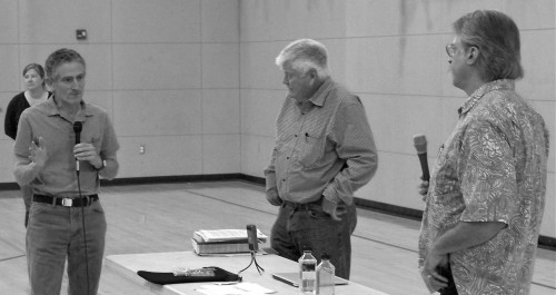
Dr. Corey Goodman of Marshall (left), who uncovered the National Park Service’s using bogus data to discredit Drakes Bay Oyster Company (owned by the Lunny family of Inverness), questions Pete McCloskey, a retired congressman (center), and Paul Berkowitz, a retired ranger and criminal investigator for the Park Service. Behind them and serving as moderator was Laura Watt, an assistant professor of Environmental Studies at Sonoma State.

During a symposium Sunday afternoon in the West Marin School gym, McCloskey and Berkowitz discussed “corruption” at the top levels of the National Park Service (NPS). Low-level rangers, they agreed, were more likely to be honest.

Berkowitz, who for 33 years was a ranger and criminal investigator for NPS, has written a book, The Case of the Indian Trader, which focuses on a particularly egregious example of corruption that occurred at the Hubbell Trading post on a Navajo reservation in Arizona. The book, however, also describes many other cases of criminal behavior by NPS staff, such as child molesting, theft of government funds, and shredding crime reports on people in NPS’s favor.

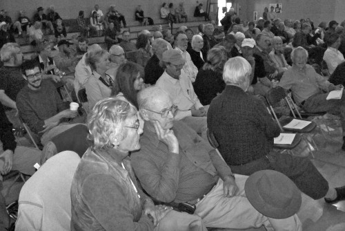
More than 115 West Marin residents showed up for the symposium, forcing organizers to put out extra chairs.

McCloskey, who spent 15 years in the House of Representatives, noted that the House Committee on Oversight and Government Reform, which is chaired by Darrell Issa (R-San Diego County), will begin an investigation on Nov. 7 of Point Reyes National Seashore officials. “The alleged misconduct is serious and could result in the loss of the Lunny family’s business,” Issa wrote Interior Department Secretary Ken Salazar. “Time is of the essence, as the family’s reservation of use expires next year.

“In light of a damaging draft Environmental Impact Statement released on Sept. 3, 2011, it is imperative that a thorough, objective review of whether NPS’s conclusions are based on flawed science occurs immediately.”

Among those summoned to testify before the committee are: Gavin Frost of the Solicitor’s Office (he has already turned up skulduggery within the Nation Seashore administration); Don Neubacher (former superintendent of the park); Jon Jarvis (NPS director, as well as the previous director of the Pacific West Region of NPS); Dr. Marcia McNutt (adviser to the NPS; Sarah Allen (former science adviser to the National Seashore); Dr. Ben Becker (NPS scientist); and Cicely Muldoon (current superintendent of the National Seashore).

McCloskey, 84, had been a colonel in the Marine Corps and was awarded the Navy Cross, the Silver Star and two Purple Hearts for outstanding service during the Korean War. The former congressman had also been a lawyer in Redwood City, a deputy district attorney in Alameda County, and a lecturer on legal ethics at the Stanford and Santa Clara law schools. He warned that any NPS official who doesn’t testify with total honestly will be charged with perjury.

Berkowtz had taken over an NPS investigation that had been triggered by Western National Parks Association allegations against Billy Malone, who operated Hubbell Trading Post. The allegations were based only on faulty intuition, but WNPA wanted Berkowtz to find something, anything, for which the trader could be prosecuted.

Berkowitz instead found that the NPS was hiding exculpatory evidence, had lied to get a search warrant, and then had seized much of Malone’s private property although the warrant did not provide for this. The case had been going on for a few years and had become expensive. WNPA, which was well over $1 million in debt, hoped to sell Malone’s personal property to pay off its debts.

The investigator said the Army’s cavalry originally kept order in national parks, which explains rangers’ uniforms. In 1916, however, the Park Service was created as a “civilian version of the military. It was disciplined, regimented, and had a rigid application of standards.” Over time, however, the Park Service abandoned critical components of military conduct, so that there’s now “an enormous variance of management competence.”

In 1976, the law that established the Park Service was strengthened, Berkowitz said, giving NPS authority to investigate all federal-law violations in national parks. He concluded by saying he loves national parks and would never want to harm them. However, he added, NPS leaders’ corruption must be stopped.

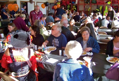
The annual pancake breakfast was held Sunday morning in the Point Reyes Station firehouse. The event is always a fundraiser for the West Marin Disaster Council and the Inverness Volunteer Fire Department.

Having fun at the pancake breakfast was Rich Clarke of Marshall, a member of the West Marin Disaster Council.

Approximately 325 people attended the pancake breakfast, and a firefighter told me the crowd was the largest in years. He credited sunny weather for bringing out so many West Marin residents.

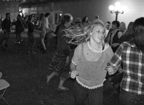
West Marin Commons sponsored a Halloween barn dance in Toby’s Feed Barn Friday evening. Band members (from left): Brian Lamoreaux on guitar, Sue Walters on bass, Ingrid Noyes on accordion, and Erik Hoffman on fiddle. Because the feed barn is unheated and the band sits next to an open door, there will be no more barn dances this season. It’s becoming too cold for the musicians.

However line dances, square dances, and even waltzes kept the dancers warm.

Angel mother Denise Spenard of Marshall and devil daughter Maia, 8, had a jolly time wearing Halloween costumes to the barn dance.

« Previous PageNext Page »